'; ?>
Pictures of England

Search:

Historic Towns & Picturesque Villages

Castle Crag slate.

Borrowdale

in the county of Cumbria

Rufford Old Hall, Lancashire

Rufford

in the county of Lancashire

Mow Cop Castle, Staffordshire

Mow Cop

in the county of Staffordshire

Recommended Towns & Villages near Bakewell

Ashford in the Water, Derbyshire

Ashford in the Water (80 Pictures)

a Picturesque Village in the county of Derbyshire (1.4 miles, 2.2 km, direction NW)

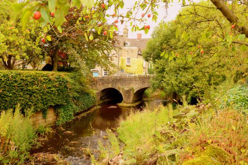
The village was a centre for candle making, noted for lead mining and made famous by the discovery of Ashford marble which was first quarried by Henry Watson in 1748...

St Peters Church

Edensor (20 Pictures)

a Picturesque Village in the county of Derbyshire (2.4 miles, 3.9 km, direction NE)

It was the 6th Duke of Devonshire who looked out of his window one day from Chatsworth House, and realised that the magnificent view of the park in front of him was blocked by a.....

Baslow

Baslow (25 Pictures)

in the county of Derbyshire (3.4 miles, 5.4 km, direction NE)

Set amidst the stark loneliness of the High Peak the village of Baslow is surrounded by some of the finest historic properties to be found in Derbyshire...

Cressbrook Mill, Cressbrook, Derbyshire

Cressbrook (13 Pictures)

a Picturesque Village in the county of Derbyshire (3.8 miles, 6.1 km, direction NW)

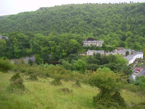
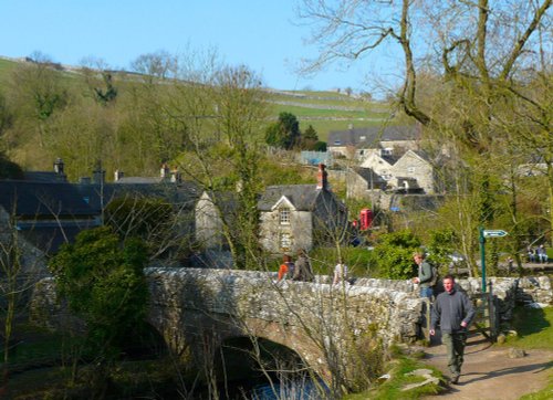
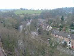
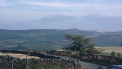
Set amidst the dramatic scenery of the glorious Peak District National Park, Cressbrook offers visitors breathtaking views from the road winding through this deep river valley. .....

The Plague Cottages, Eyam, Derbyshire

Eyam (17 Pictures)

a Picturesque Village in the county of Derbyshire (4.8 miles, 7.7 km, direction N)

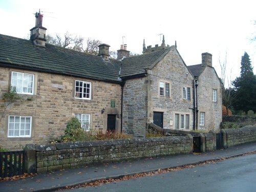
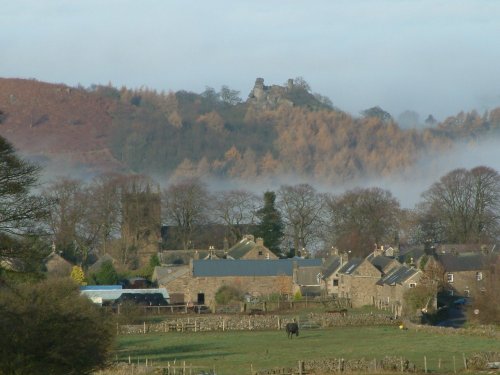
Setting its chilling history to one side, this is a village with a lot to offer. It is hidden away in a matchless location above the limestone peaks of Middleton Dale in the Peak District...

Robin Hoods Stride, Beyond Elton, Derbyshire

Elton (13 Pictures)

a Picturesque Village in the county of Derbyshire (4.8 miles, 7.7 km, direction S)

This unspoilt small peakland village stands 950 feet above sea level offering stunning views of the peakland countryside. It is a very tradional village, which had its own fire.....

Winster. A village in Derbyshire

Winster (21 Pictures)

in the county of Derbyshire (5.1 miles, 8.2 km, direction S)

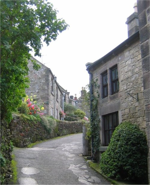
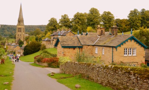
Today, this graceful village with its sweeping main street and quiet little alleyways is a tourist destination of character and charm...

Tideswell Church, known as 'Cathedral of the Peak'. The centre piece of the village.

Tideswell (5 Pictures)

in the county of Derbyshire (5.9 miles, 9.6 km, direction NW)

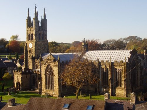
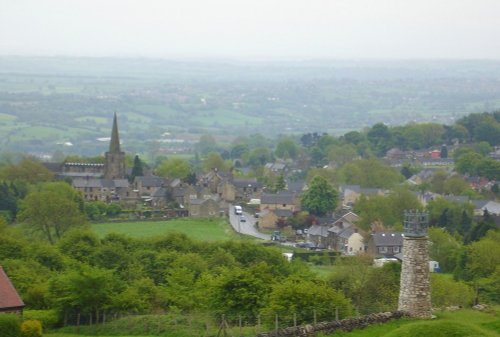
Tideswell is famous for its superb, large church, known as the "Cathedral of the Peak"...

Tissington Trail

Hartington (34 Pictures)

in the county of Derbyshire (7.4 miles, 11.9 km, direction SW)

Hartington is a small village centred around a medieval market place, with attractive 18th and 19th century buildings...

Hathersage, Derbyshire

Hathersage (59 Pictures)

a Picturesque Village in the county of Derbyshire (8.0 miles, 12.8 km, direction N)

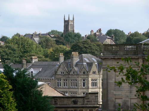
The town now takes advantage of its superb position, operating mostly as an attractive place for tourists...

The Town

Matlock Bath (96 Pictures)

in the county of Derbyshire (8.0 miles, 12.9 km, direction SE)

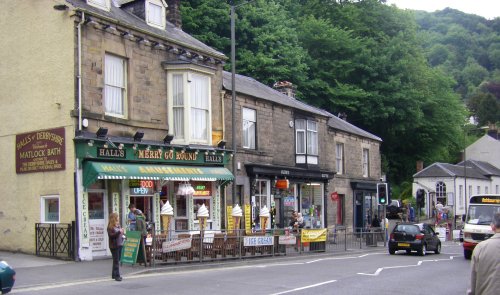
Matlock Bath lies amongst some of the most beautiful river-valley country in England...

Middleton by Wirksworth, Derbyshire: scene near Middleton Top

Middleton by Wirksworth (7 Pictures)

in the county of Derbyshire (8.9 miles, 14.2 km, direction SE)

..

View of Mam Tor from Peveril Castle, Castleton, Derbyshire. - July 06.

Castleton (217 Pictures)

a Picturesque Village in the county of Derbyshire (9.8 miles, 15.8 km, direction NW)

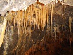
Castleton is one of the Jewels of the Peak District. It is a famous centre for caverns where you will find four of the countries most famous show caves. It is also the home of.....

Milldale

Milldale (10 Pictures)

in the county of Derbyshire (10.0 miles, 16.1 km, direction SW)

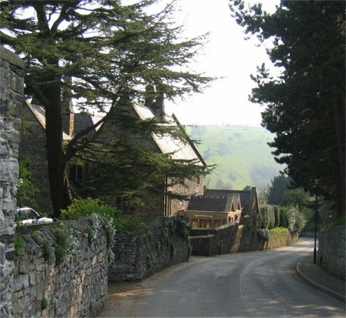
Milldale is a glorious stone village lying in scenic countryside towards the southern fringes of the Peak District National Park...

View of Buxton, Derbyshire.

Buxton (81 Pictures)

a Historic Market Town in the county of Derbyshire (10.4 miles, 16.7 km, direction W)

This barely spoilt town offers an exciting opportunity to enjoy a town crammed with beautiful buildings whilst exploring the high upland regions of England's glorious Peak District National Park...

St Mary and All Saints Church in Chesterfield, Derbyshire

Chesterfield (75 Pictures)

a Historic Market Town in the county of Derbyshire (10.7 miles, 17.1 km, direction E)

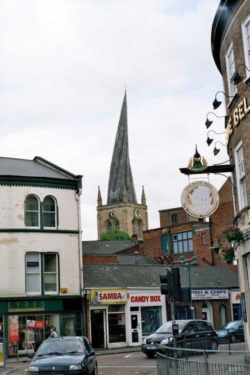
Chesterfield is an attractive town close to the dramatic peaks of the Peak District National Park. It is well known for its strange landmark, the crooked spire of its parish.....

Riverside entrance to Ilam Park

Ilam (58 Pictures)

a Picturesque Village in the county of Derbyshire (12.2 miles, 19.6 km, direction SW)

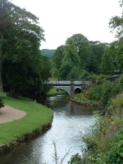
A pretty and popular village which includes a wonderful park which is part of Ilam Hall. Enjoy wonderful walks through the park and the lovely river Manifold. The village is set.....

A view of Crich, Derbyshire and the beautiful countryside around it.

Crich (63 Pictures)

in the county of Derbyshire (12.2 miles, 19.7 km, direction SE)

A village on the edge of the Peak District National Park with a Museum dedicated solely to the golden era of the Tramcar. Also famous as being the location for filming Peak Practice...

Chapel-en-le-Frith, Eccles Pike Topograph

Chapel-en-le-Frith (5 Pictures)

in the county of Derbyshire (12.3 miles, 19.8 km, direction NW)

Chapel is a well preserved, picturesque place. It has a lovely old church dating back to the 14th-century which stands on the spot of an earlier church built by foresters a century or so before...

This is the front of Sutton Scarsdale Hall, Sutton Scarsdale, Derbyshire

Sutton Scarsdale (18 Pictures)

in the county of Derbyshire (13.9 miles, 22.3 km, direction E)

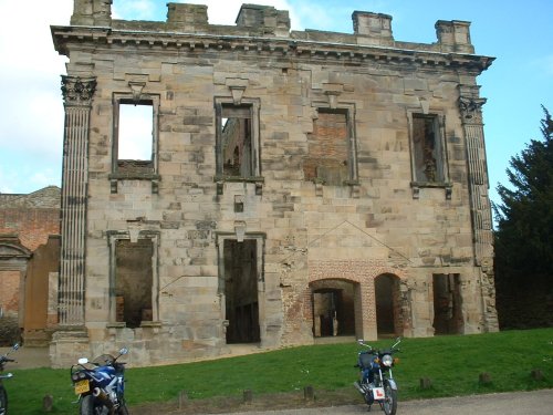
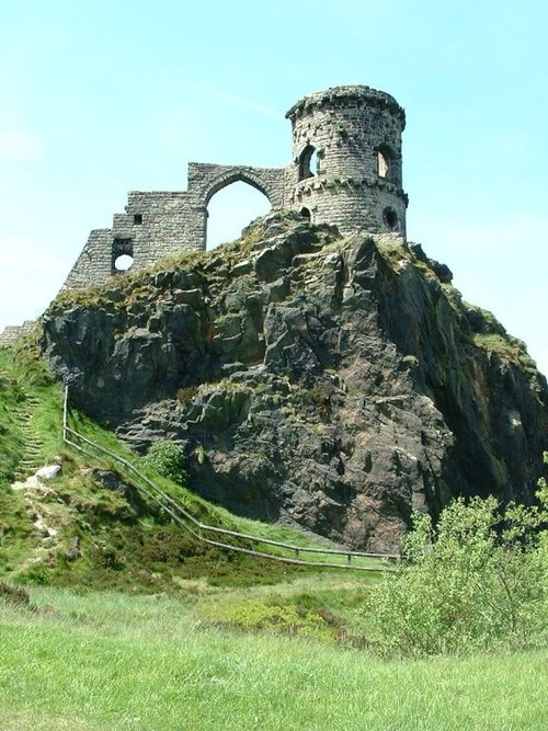
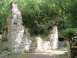
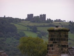
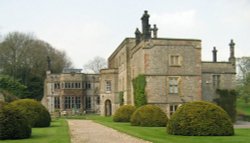
This is a village noted for the romantic ruins of what was once one of the grandest houses in Derbyshire...

Recommended attractions near Bakewell

The central courtyard, Haddon Hall, Derbyshire

Haddon Hall (48 Pictures)

(1.9 miles, 3.0 km, direction SE)

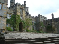
Perched in a picturesque position above the Derbyshire River Wye, the grey stone walls of Haddon House tempt invitingly, and you.....

Batemans House, Lathkill Dale, near Alport, Derbyshire Peak District

Lathkill Dale (7 Pictures)

(2.6 miles, 4.1 km, direction SW)

This is one of the Peak Districts hidden gems, not only is the scenery highly picturesque but the region is full of interesting.....

Chatsworth House

Chatsworth House (281 Pictures)

(2.8 miles, 4.5 km, direction E)

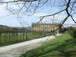
The magnificent Classical mansion that is Chatsworth House, is one of the most celebrated Historic Houses in England. Built in.....

Nine ladies stone circle

Nine Ladies Stone Circle, Stanton Moor (4 Pictures)

(3.8 miles, 6.1 km, direction SE)

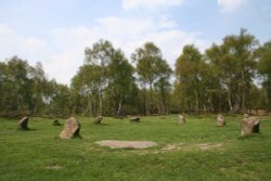
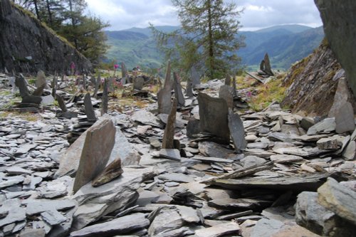
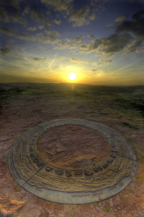
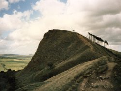
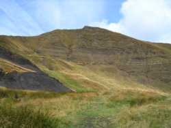
This wild eyrie stretch of moorland has an invigorating, yet gloomy feel to it and looking around at the barrows left from the.....

Robin Hood's Stride, Derbyshire.

Robin Hood's Stride (8 Pictures)

(4.0 miles, 6.4 km, direction S)

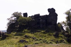
Robin Hood's Stride is a rocky outcrop overlooking the pretty village of Elton, in Derbyshire. By tradition the sole province of.....

A picture of Peak District National Park

Peak District National Park (407 Pictures)

(5.5 miles, 8.8 km, direction N)

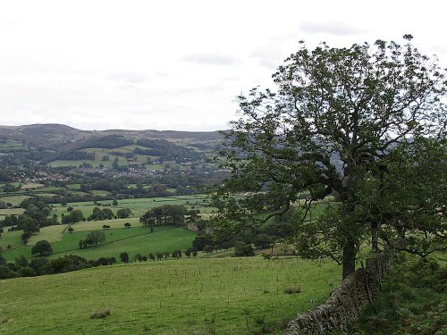
The varied and seductive scenery of the Peak District National Park rivals the scenic beauty of any where in the land. It is an.....

Heights of Abraham

The Heights of Abraham (20 Pictures)

(7.9 miles, 12.7 km, direction SE)

..

No picture available

Gullivers Kingdom

(8.0 miles, 12.8 km, direction SE)

..

Derilect Riber Castle, Matlock, Derbyshire

Riber Castle (2 Pictures)

(8.3 miles, 13.3 km, direction SE)

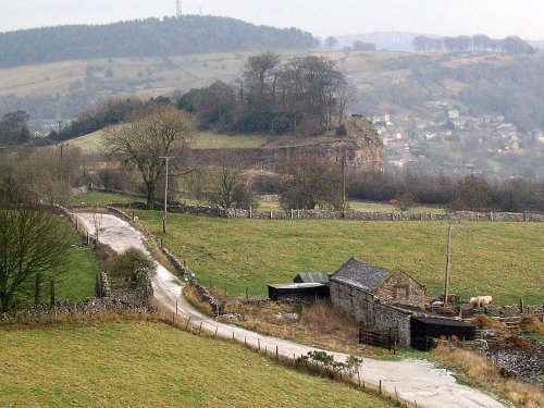
The Matlocks between them form some of the most outstanding countryside in the Peak District. Here you can find Riber Castle.....

Mam Tor in Hope Valley, Derbyshire

Hope Valley (6 Pictures)

(9.4 miles, 15.1 km, direction NW)

..

Inside the entrance to Peak Cavern Cave, in Castleton, Derbyshire

Peak Cavern (13 Pictures)

(9.7 miles, 15.6 km, direction NW)

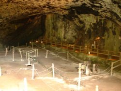
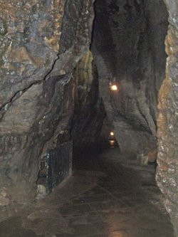
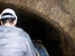
Peak Cavern is one of the finest of the many underground caverns of this area. It lies beneath Peveril Castle at the centre of.....

The Keep at Peveril Castle

Peveril Castle (31 Pictures)

(9.7 miles, 15.6 km, direction NW)

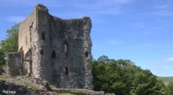
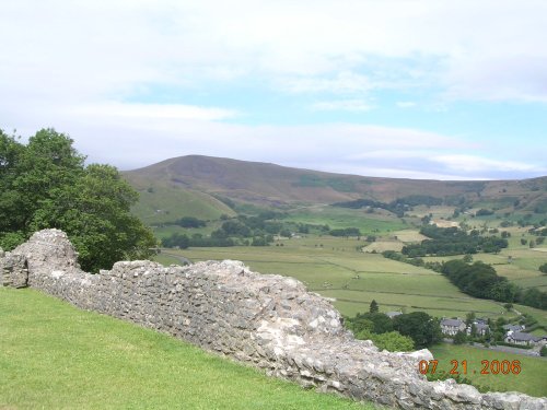
Built to be impregnable, the ruins of Peveril Castle stand on a steep ridge with dramatic views in all directions, giving the.....

Inside the Blue John Cavern (04-05-2006)

Blue John Cavern (18 Pictures)

(9.8 miles, 15.8 km, direction NW)

..

Stalagtites in Treak Cliff Cavern, Derbyshire, UK

Treak Cliff Cavern (3 Pictures)

(10.3 miles, 16.5 km, direction NW)

..

Towards Stanage on an Autumn day

Stanage Edge (26 Pictures)

(10.3 miles, 16.6 km, direction N)

Stanage Edge is an elevated gritstone edge or enscarpment that stretches for around 4 miles giving extensive views across the.....

A picture of Speedwell Cavern

Speedwell Cavern (5 Pictures)

(10.4 miles, 16.7 km, direction NW)

..

The Pavilion Gardens, Buxton, Derbyshire

Pavilion Gardens, Buxton (1 Pictures)

(10.4 miles, 16.8 km, direction W)

..

Tissington Hall

Tissington Hall (8 Pictures)

(10.6 miles, 17.1 km, direction S)

Dating from Jacobean times, Tissington Hall has been lived in by the FitzHerbert family for 500 years and is set in the beautiful.....

Carsington waters, Ashbourne, Derbyshire. Looking over waters from island point

Carsington Water (49 Pictures)

(11.0 miles, 17.7 km, direction S)

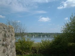
Carsington Water is situated close to the village of Carsington in the lower regions of Derbyshire. Carsington Water is a large.....

Thorpe Cloud on the right at Dovedale

Dovedale (62 Pictures)

(11.0 miles, 17.7 km, direction SW)

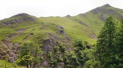
The River Dove flows through one of England's loveliest valleys. Though little more than a mile long, Dove Dale shows a variety.....


All attractions in Bakewell
All attractions in Derbyshire