Pictures of England

Search:

Historic Towns & Picturesque Villages

Hurst Castle on the Isle of White

Cowes

in the county of Isle of Wight

A view of the beach and pill box at Hemsby near Yarmouth, Norfolk

Hemsby

in the county of Norfolk

Recommended Towns & Villages near Chapel-en-le-Frith

A picture of Whaley Bridge

Whaley Bridge (13 Pictures)

in the county of Derbyshire (3.0 miles, 4.9 km, direction W)

An attractive small town in the High Peak district of Derbyshire...

Buxton Crescent

Buxton (81 Pictures)

a Historic Market Town in the county of Derbyshire (4.6 miles, 7.4 km, direction S)

This barely spoilt town offers an exciting opportunity to enjoy a town crammed with beautiful buildings whilst exploring the high upland regions of England's glorious Peak District National Park...

View of the Churchyard

Castleton (217 Pictures)

a Picturesque Village in the county of Derbyshire (5.7 miles, 9.2 km, direction E)

Castleton is one of the Jewels of the Peak District. It is a famous centre for caverns where you will find four of the countries most famous show caves. It is also the home of.....

Tideswell Church, known as 'Cathedral of the Peak'. The centre piece of the village.

Tideswell (5 Pictures)

in the county of Derbyshire (6.5 miles, 10.4 km, direction SE)

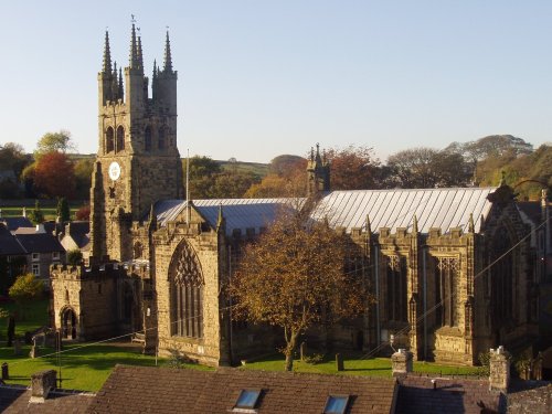
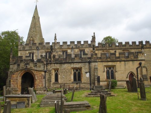
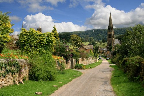
Tideswell is famous for its superb, large church, known as the "Cathedral of the Peak"...

Marple, Greater Manchester

Marple (24 Pictures)

in the county of Greater Manchester (8.0 miles, 12.9 km, direction NW)

Marple has many splendid canal features from the past, these include a flight of 16 locks and a three arched aqueduct which takes the Peak Forest canal over the River Goyt...

Cressbrook Mill Water, Derbyshire

Cressbrook (13 Pictures)

a Picturesque Village in the county of Derbyshire (8.6 miles, 13.8 km, direction SE)

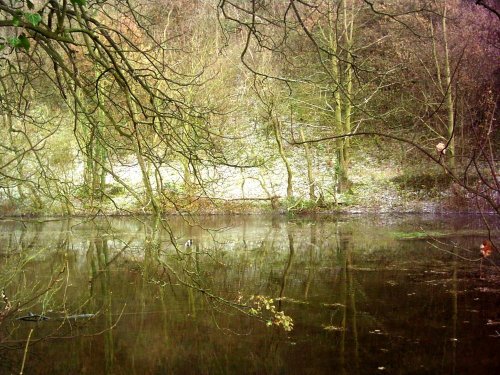
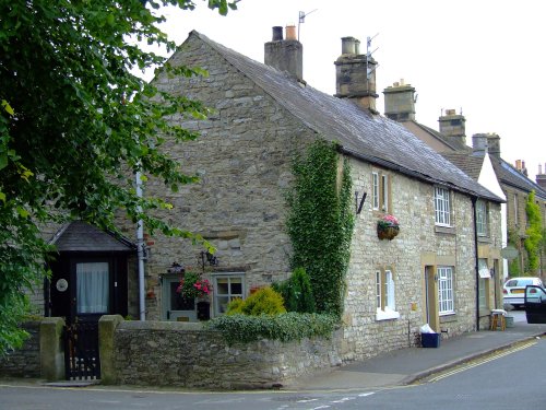
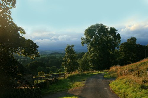
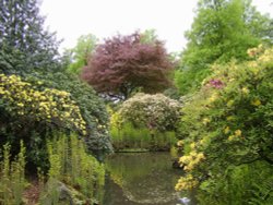
Set amidst the dramatic scenery of the glorious Peak District National Park, Cressbrook offers visitors breathtaking views from the road winding through this deep river valley. .....

A picture of Macclesfield

Macclesfield (13 Pictures)

a Historic Market Town in the county of Cheshire (9.9 miles, 15.8 km, direction SW)

A small Market town in Cheshire..

The Riley Graves, Eyam

Eyam (17 Pictures)

a Picturesque Village in the county of Derbyshire (10.2 miles, 16.3 km, direction E)

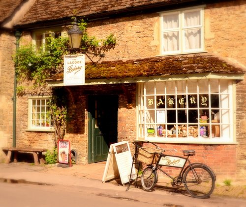
Setting its chilling history to one side, this is a village with a lot to offer. It is hidden away in a matchless location above the limestone peaks of Middleton Dale in the Peak District...

Stanage Edge

Hathersage (59 Pictures)

a Picturesque Village in the county of Derbyshire (10.5 miles, 16.9 km, direction E)

The town now takes advantage of its superb position, operating mostly as an attractive place for tourists...

Bramall Hall

Bramhall (8 Pictures)

in the county of Greater Manchester (10.9 miles, 17.6 km, direction W)

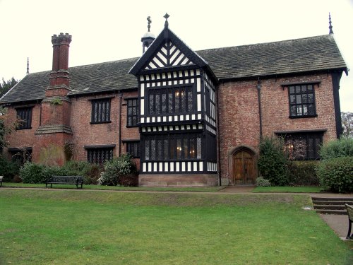
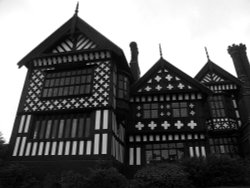
Set in an area where Cotton was once king, midst the towns of Manchester and the quiet rolling acres of sprawling Cheshire countryside, lies the little town of Bramhall whose most famous feature is Bramall Hall...

Stone built houses, Ashford

Ashford in the Water (80 Pictures)

a Picturesque Village in the county of Derbyshire (11.0 miles, 17.6 km, direction SE)

The village was a centre for candle making, noted for lead mining and made famous by the discovery of Ashford marble which was first quarried by Henry Watson in 1748...

River Wye and bridge at Bakewell

Bakewell (202 Pictures)

a Historic Market Town in the county of Derbyshire (12.3 miles, 19.8 km, direction SE)

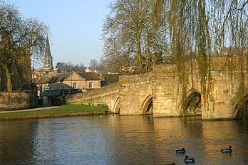
Bakewell is the largest town in the Peak District National Park. It is an old town full of glowing stone houses and buildings that lend an air of ambience and overall warmth...

St Anne's Parish Church, Baslow, Derbyshire, dates from the thirteenth century.

Baslow (25 Pictures)

in the county of Derbyshire (13.0 miles, 20.8 km, direction SE)

Set amidst the stark loneliness of the High Peak the village of Baslow is surrounded by some of the finest historic properties to be found in Derbyshire...

A picture of Reddish

Reddish (37 Pictures)

in the county of Greater Manchester (13.1 miles, 21.1 km, direction NW)

This is a densely populated area of Stockport, Greater Manchester. It is fortunate to be close to the edge of Cheshire, thus residents have the benefit of being within easy reach of some attractive countryside...

Evening near Hartington

Hartington (34 Pictures)

in the county of Derbyshire (13.6 miles, 21.8 km, direction S)

Hartington is a small village centred around a medieval market place, with attractive 18th and 19th century buildings...

This is St Stephens Church, which is in Audenshaw.

Audenshaw (2 Pictures)

in the county of Greater Manchester (13.6 miles, 21.8 km, direction NW)

Audenshaw is a suburb of Greater Manchester. It is probably best known for its reservoirs and the busy waters of the Ashton canal, beside which visitors can see clusters of delightful canal-side properties...

Edensor

Edensor (20 Pictures)

a Picturesque Village in the county of Derbyshire (13.7 miles, 22.0 km, direction SE)

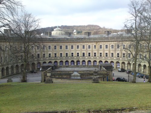
It was the 6th Duke of Devonshire who looked out of his window one day from Chatsworth House, and realised that the magnificent view of the park in front of him was blocked by a.....

View from Stormy Point, Alderley Edge, Cheshire

Alderley Edge (16 Pictures)

a Picturesque Village in the county of Cheshire (13.7 miles, 22.0 km, direction W)

Alderley Edge is a popular tourist spot in the county of Cheshire, consisting of a prominent 'edge' or sandstone ridge which is popular with walkers and offers stunning views. You.....

A picture of Quarry Bank Mill & Styal Estate

Styal (16 Pictures)

in the county of Cheshire (14.3 miles, 23.0 km, direction W)

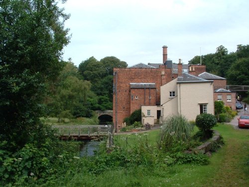
The village of Styal stands on the River Bollin close to the town of Wilmslow. It is renowned for Quarry Bank Mill and the surrounding Styal Estate with houses once occupied by the mill workers...

Lake Rudyard, Nr Leek, Staffordshire

Rudyard (3 Pictures)

in the county of Staffordshire (15.8 miles, 25.3 km, direction SW)

A pretty village with a delightful cluster of cottages and houses with lovely gardens, bordered by woods at the south end of the picturesque Rudyard Reservoir...

Recommended attractions near Chapel-en-le-Frith

Stalagtites in Treak Cliff Cavern, Derbyshire, UK

Treak Cliff Cavern (3 Pictures)

(4.8 miles, 7.7 km, direction E)

..

A picture of Speedwell Cavern

Speedwell Cavern (5 Pictures)

(5.0 miles, 8.0 km, direction E)

..

The Pavilion Gardens, Buxton, Derbyshire

Pavilion Gardens, Buxton (1 Pictures)

(5.2 miles, 8.4 km, direction S)

..

Inside the Blue John Cavern (04-05-2006)

Blue John Cavern (18 Pictures)

(5.5 miles, 8.8 km, direction E)

..

Inside the entrance to Peak Cavern Cave, in Castleton, Derbyshire

Peak Cavern (13 Pictures)

(5.5 miles, 8.8 km, direction E)

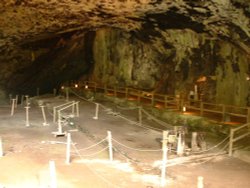
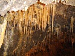
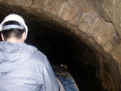
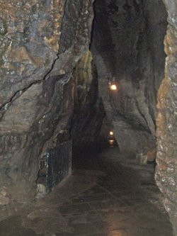
Peak Cavern is one of the finest of the many underground caverns of this area. It lies beneath Peveril Castle at the centre of.....

The stunning Goyt Valley near Buxton, Derbyshire

Goyt's Moss (3 Pictures)

(5.5 miles, 8.9 km, direction SW)

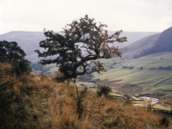
Goyt's Moss lies in the wild and beautiful Goyt Valley, its steep slopes sweep down into the tranquil waters of the Fernlee.....

The Keep at Peveril Castle

Peveril Castle (31 Pictures)

(5.6 miles, 9.1 km, direction E)

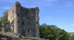
Built to be impregnable, the ruins of Peveril Castle stand on a steep ridge with dramatic views in all directions, giving the.....

Bidulph Grange Gardens

Lyme Park (51 Pictures)

(6.1 miles, 9.8 km, direction W)

Set amidst the grandeur of the high Peaks amongst softly rolling countryside of undisputed splendour is the magnificent house.....

Mam Tor in Hope Valley, Derbyshire

Hope Valley (6 Pictures)

(6.1 miles, 9.9 km, direction E)

..

Alport Dale, Hope Forest, Derbyshire (Peak District National Park)

Alport Castles (3 Pictures)

(7.3 miles, 11.7 km, direction NE)

Alport Castles refers to a striking natural feature in the Peak District National Park, Derbyshire, England. Despite its name,.....

view from the summit of Tegg's Nose

Tegg's Nose Country Park (8 Pictures)

(8.9 miles, 14.3 km, direction SW)

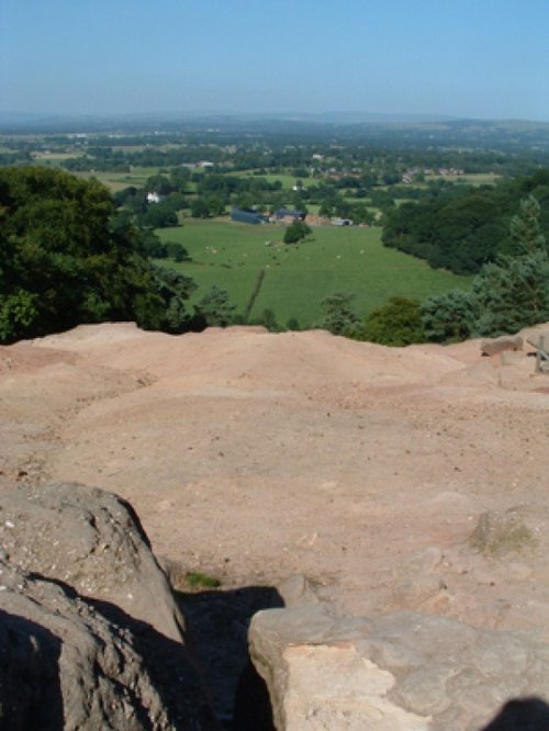
Tegg's Nose Country Park comprises mainly of wild untamed countryside high above Macclesfield. It offers nature lovers many.....

Ladybower Reservoir, Derbyshire. October 2004

Ladybower Reservoir (108 Pictures)

(9.0 miles, 14.5 km, direction NE)

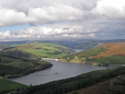
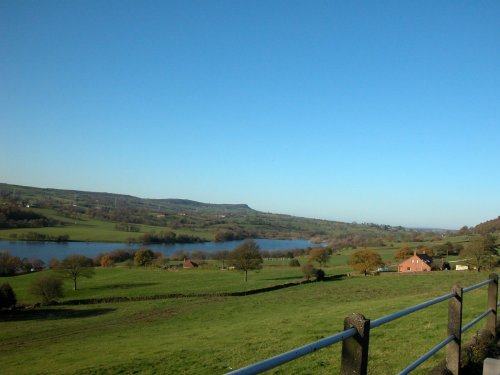
This beautiful reservoir is found in the undulating Derbyshire countryside. It is the lowest of the Peak districts three.....

A picture of Peak District National Park

Peak District National Park (407 Pictures)

(9.1 miles, 14.7 km, direction E)

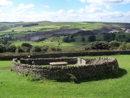
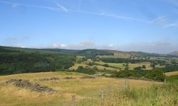
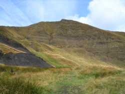
The varied and seductive scenery of the Peak District National Park rivals the scenic beauty of any where in the land. It is an.....

Leathers Smithy, Macclesfield Forest

Leathers Smithy (1 Pictures)

(9.2 miles, 14.8 km, direction SW)

Dating form the 18th Century and standing in beautiful surroundings, on the edge of Macclesfield Forest Reservoir, this stone.....

Towards Stanage on an Autumn day

Stanage Edge (26 Pictures)

(11.1 miles, 17.8 km, direction E)

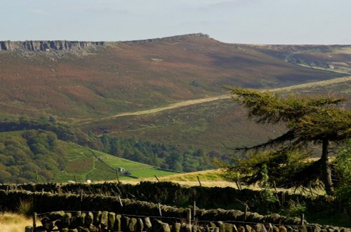
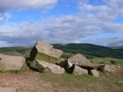
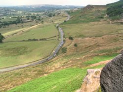
Stanage Edge is an elevated gritstone edge or enscarpment that stretches for around 4 miles giving extensive views across the.....

Bramall Hall, Manchester

Bramall Hall (3 Pictures)

(11.2 miles, 18.0 km, direction W)

..

View from The Roaches

The Roaches (72 Pictures)

(11.4 miles, 18.3 km, direction S)

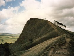
The spectacular Roaches are situated at the end of the Pennine Way, these together with oddly named Hen Cloud contrive between.....

Batemans House, Lathkill Dale, near Alport, Derbyshire Peak District

Lathkill Dale (7 Pictures)

(12.1 miles, 19.5 km, direction SE)

This is one of the Peak Districts hidden gems, not only is the scenery highly picturesque but the region is full of interesting.....

Reddish Vale, viaduct on winter's evening.

Reddish Vale Country Park (6 Pictures)

(12.4 miles, 20.0 km, direction NW)

..

Robin Hood

Bradfield Moors (3 Pictures)

(13.0 miles, 20.9 km, direction NE)

..


All attractions in Chapel-en-le-Frith
All attractions in Derbyshire