'; ?>
Pictures of England

Search:

Historic Towns & Picturesque Villages

Highcliffe, Dorset

Highcliffe

in the county of Dorset

Birmingham Botanical Gardens

Edgbaston

in the county of West Midlands

Recommended Towns & Villages near Bardon Mill

The Church at Whitfield, Northumberland

Whitfield (2 Pictures)

a Picturesque Village in the county of Northumberland (4.2 miles, 6.8 km, direction S)

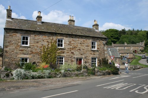
This is a picturesque village lying amongst sprawling open countryside criss crossed by dancing streams, tributaries of the River West Allen...

Allendale village, Northumberland

Allendale Town (23 Pictures)

a Picturesque Village in the county of Northumberland (6.6 miles, 10.6 km, direction SE)

This picturesque Northumberland village enjoys a lovely location in the fine hill and dale countryside of the beautiful East Allen Valley...

St.Michael's Church in the village of WALL in the county of NORTHUMBERLAND - August 2003

Wall (1 Pictures)

a Picturesque Village in the county of Northumberland (8.3 miles, 13.3 km, direction E)

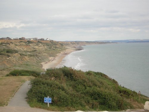
The village of Wall lies in the high uplands of Northumberland in spacious countryside bordered by the rivers South Tyne and North Tyne, close to Chester's Fort on historic Hadrian's Wall...

Hexham bridge

Hexham (35 Pictures)

a Historic Market Town in the county of Northumberland (8.8 miles, 14.2 km, direction E)

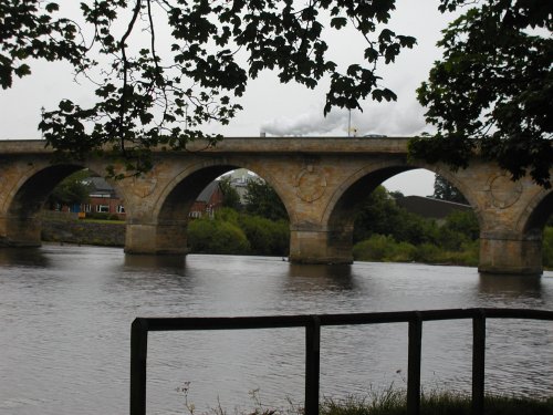
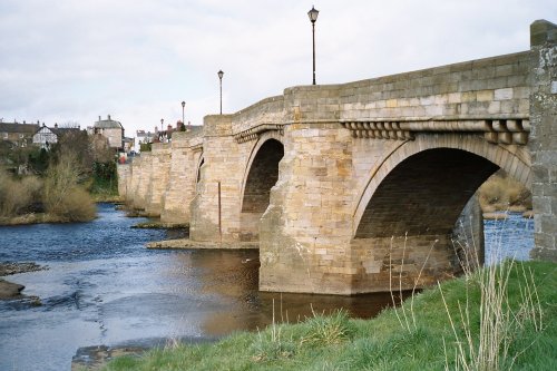
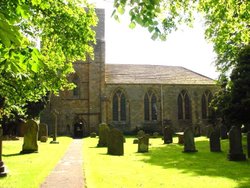
Historic market town where for centuries the sheep and cattle farmers of Northumberland gathered for the Tuesday market beside Hexham Abbey...

Remants of Hadrians Wall, Chesters Roman Fort, Northumberland

Chollerford (26 Pictures)

in the county of Northumberland (8.8 miles, 14.2 km, direction NE)

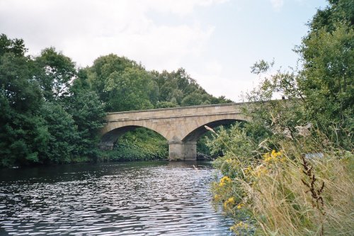
Chollerford is a delightful village destination. It is a popular base for tourists visiting Hadrian's Wall and Chester Fort. The region is also popular with keen fishermen, with.....

Bellingham Bridge

Bellingham (7 Pictures)

a Historic Market Town in the county of Northumberland (12.0 miles, 19.3 km, direction N)

The market town of Bellingham sits on one of Northumberland's prettiest stretches of water, the north bank of the River North Tyne...

St Augustine's Church, Alston, Cumbria

Alston (32 Pictures)

a Historic Market Town in the county of Cumbria (12.2 miles, 19.6 km, direction S)

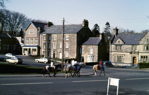
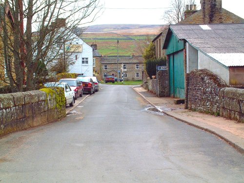
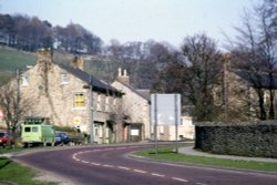
At a height of over 1,000 feet in the far reaches of the Pennines, this is one of England's highest market towns. Alston is a lively bustling place of steeply rising narrow.....

Corbridge Bridge

Corbridge (31 Pictures)

a Picturesque Village in the county of Northumberland (12.6 miles, 20.2 km, direction E)

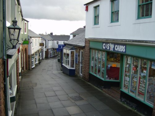
Located in Northumberland, Corbridge is a historic market town with Roman connections. It features charming streets, historic buildings, and the Corbridge Roman Town archaeological site...

Mining Remains, Nenthead, Cumbria

Nenthead (14 Pictures)

a Picturesque Village in the county of Cumbria (13.2 miles, 21.2 km, direction S)

Nestling beside the sparkling River Nent, Nenthead lies on Alston Moor, in a lonely remote North Pennine Area of Outstanding Natural Beauty, between the pleasant market town of Alston and the Killhope lead mining museum...

Blanchland

Blanchland (38 Pictures)

a Picturesque Village in the county of Northumberland (14.6 miles, 23.5 km, direction SE)

Blanchland is a small picturesque village nestled beside the river in the Derwent Valley within the North Pennines Area Of Outstanding Natural Beauty. It is surrounded by.....

Garrigill in Cumbria

Garrigill (13 Pictures)

in the county of Cumbria (14.8 miles, 23.8 km, direction S)

This delightful place can be found on the banks of the South Tyne River, it is also on the route of the arduous Pennine Way surrounded by numerous beauty spots. The village.....

A picture of Talkin Tarn Country Park

Brampton (26 Pictures)

in the county of Cumbria (16.2 miles, 26.1 km, direction W)

One of the loveliest features of Brampton is its octagonal Moot Hall, built by the Earl of Lancaster in 1817...

A view of Elsdon village in Northumberland. taken july 2006

Elsdon (2 Pictures)

in the county of Northumberland (20.0 miles, 32.2 km, direction NE)

In this gentle setting the village, with its scattering of 18th-century properties around a picturesque village green, is the perfect example of English village life...

Where sheep shall graze

Stanhope (27 Pictures)

in the county of County Durham (20.4 miles, 32.8 km, direction SE)

This is a lovely, bustling little town is set amidst the charm of Weardale, it is almost entirely built of stone particularly around the old Market Square, dominated by a fine stone cross...

Keilder Water

Kielder (57 Pictures)

in the county of Northumberland (20.4 miles, 32.8 km, direction NW)

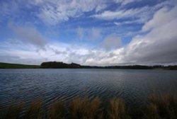
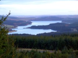
This small historic village lies at the northernmost edge of Kielder Water, it takes its name from the Kielder Burn the stream that links with the Deadwater Burn to form the North Tyne River...

Near Bolam in Northumberland.

Bolam (3 Pictures)

a Picturesque Village in the county of Northumberland (21.5 miles, 34.7 km, direction NE)

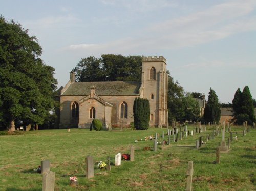
This is an historic village, it took its name from a Baron de Bolam in the 13th century...

Barking up the wrong tree

Wolsingham (18 Pictures)

a Historic Market Town in the county of County Durham (24.7 miles, 39.7 km, direction SE)

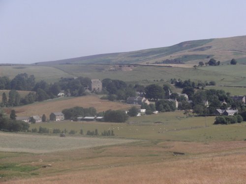
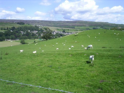
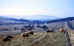
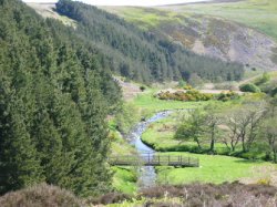
This is a lovely village lying on the edge of the North Pennines in an area of great scenic beauty. It is a wild and beautiful landscape dotted only by scattered farms with meadows full of grazing sheep and cattle...

Poets Walk, Penrith, Cumbria

Penrith (49 Pictures)

a Historic Market Town in the county of Cumbria (27.5 miles, 44.3 km, direction SW)

..

Fall Berries at Craigside, England

Craigside (2 Pictures)

in the county of County Durham (27.8 miles, 44.7 km, direction SE)

..

Recommended attractions near Bardon Mill

Hadrian's Wall

Hadrian's Wall & Housesteads Fort (36 Pictures)

(2.4 miles, 3.9 km, direction N)

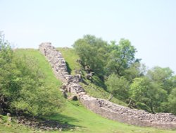
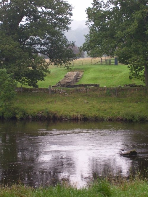
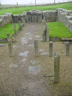
Wild and evocative remains of the Roman Empire's most northerly defences, with panoramic views. Roman barracks and some of the.....

Langley Castle Hotel, Tynedale, Northumberland

Langley Castle (3 Pictures)

(3.3 miles, 5.4 km, direction SE)

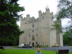
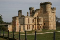
Built in 1350, during the reign of Edward III, the castle has retained its architectural integrity and is regarded as one of the.....

Mithraeum temple near Brocolitia roman fort Milecastle

Carrawburgh Roman Fort (Brocolitia) (2 Pictures)

(6.3 miles, 10.1 km, direction NE)

..

The River North Tyne

Chesters Roman Fort (Cilvrnvm) (71 Pictures)

(8.1 miles, 13.0 km, direction NE)

..

Hexham Abbey, Northumberland

Hexham Abbey (10 Pictures)

(9.2 miles, 14.8 km, direction E)

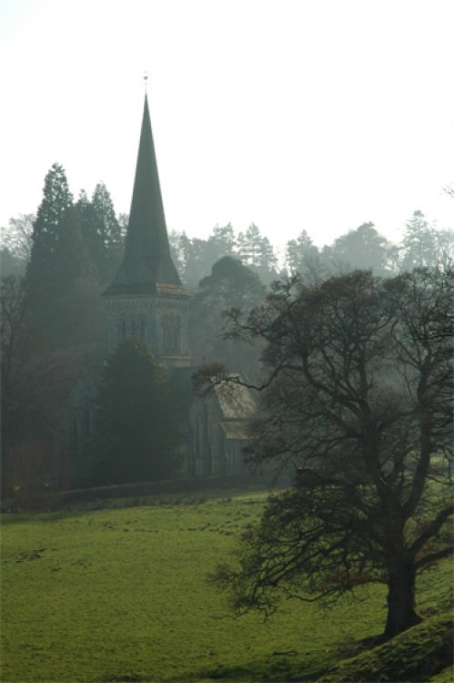
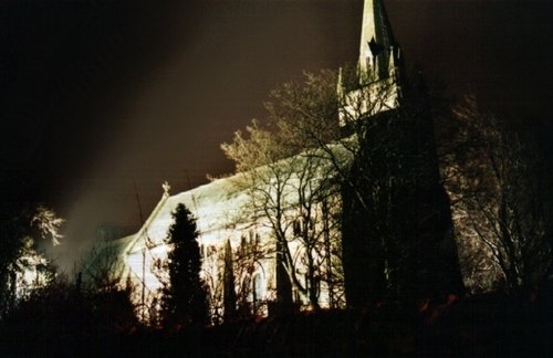
Hexham Abbey is a refoundation of a church which stood on this spot in the year 675, it survived until 821, later the town was.....

A picture of Tyne Green Country Park

Tyne Green Country Park (1 Pictures)

(9.2 miles, 14.9 km, direction E)

..

Killhope Lead Mining Museum high in Upper Weardale. A desolate but magical place.

Killhope Lead Mining Museum (7 Pictures)

(13.8 miles, 22.3 km, direction S)

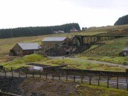
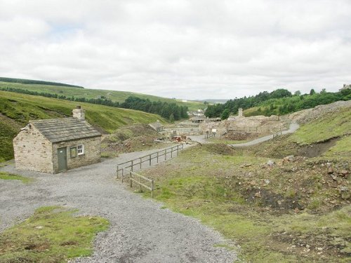
Killhope Lead Mining Museum keeps alive the counties lead mining traditions. This is a fully restored site of a working mine.....

Blanchland Abbey, Northumberland

Blanchland Abbey (1 Pictures)

(14.4 miles, 23.1 km, direction SE)

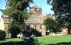
Blanchland Abbey was founded as a priory in 1165 by Walter de Bolbec II, and became an abbey in the late 13th century. The.....

Just before the snow arrived... -  - taken at Talkin Tarn country park

Talkin Tarn Country Park (26 Pictures)

(15.3 miles, 24.6 km, direction W)

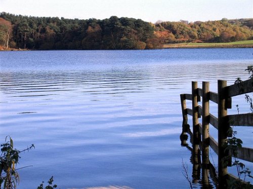
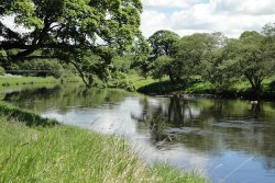
This lovely country park occupies a magical landscape close to the historic market town of Brampton. The icy waters forming the.....

A picture of Kielder Water

Kielder Water (27 Pictures)

(15.3 miles, 24.7 km, direction NW)

..

Frosterly in Weardale, County Durham

Weardale (20 Pictures)

(17.8 miles, 28.7 km, direction SE)

This lovely scenic valley lies between the town of Bishop Auckland, seat of princes of the church and the charming market town of.....

Belsay Castle

Belsay Hall & Gardens (119 Pictures)

(20.7 miles, 33.3 km, direction NE)

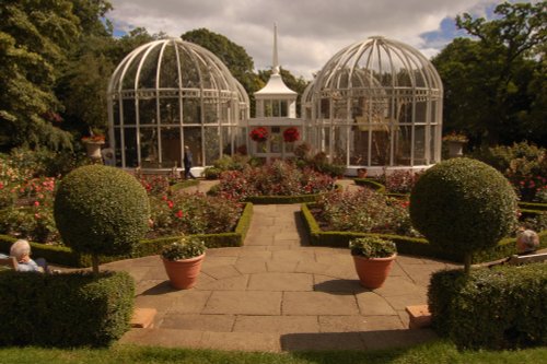
The dramatic gardens of the Belsay Hall estate are listed Grade I in the Register of Parks and Gardens. They surround a superb.....

A picture of Redesdale

Redesdale (1 Pictures)

(21.2 miles, 34.1 km, direction N)

..

Bolam Lake, Northumberland

Bolam Lake Country Park (1 Pictures)

(21.2 miles, 34.1 km, direction NE)

Bolam Lake Country Park occupies a lovely landscape amidst rich Northumbrian countryside. It has lovely watery areas enriched.....

Ravens Crag and the Allerhope Burn, The Cheviot Hills, Northumberland.

The Cheviot Hills (12 Pictures)

(21.4 miles, 34.4 km, direction N)

The clearly defined peaks of the glorious Cheviot Hills dominate the western side of the border territory as it juts boldly out.....

A Walk in the Cheviots, Northumberland

Northumberland National Park (63 Pictures)

(21.4 miles, 34.4 km, direction N)

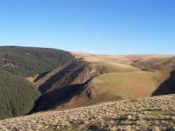
The Northumberland National Park is surely Northumberland's special blessing. It is an area of wild, desolate moorland and dark,.....

Long Meg & her Daughters (Maughanby Circle)- near Penrith, Cumbria

Long Meg & her Daughters (14 Pictures)

(21.8 miles, 35.1 km, direction SW)

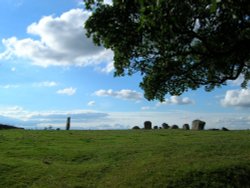
The 12 foot high mass of sandstone known as Long Meg can be found close to a circle of smaller "daughter" stones in a spectacular.....

Lordenshaw, near Rothbury, Northumberland, England

Lordenshaw (2 Pictures)

(26.9 miles, 43.2 km, direction NE)

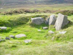
Ancient cup-and-ring marked outcrop and Iron Age hillfort in Northumberland National Park..


All attractions in Bardon Mill
All attractions in Northumberland