Pictures of England

Search:

Historic Towns & Picturesque Villages

Waterfall at Roche Abbey

Maltby

in the county of South Yorkshire

A picture of Gainsborough Old Hall

Gainsborough

in the county of Lincolnshire

Recommended Towns & Villages near Oswestry

Early Morning.

Ellesmere (8 Pictures)

in the county of Shropshire (7.4 miles, 11.9 km, direction NE)

Ellesmere, has a lovely 'holiday' atmosphere which gives it an 'away from it all' feel...

Colemere near Ellesmere in Shropshire, UK.

Colemere (2 Pictures)

in the county of Shropshire (9.2 miles, 14.8 km, direction E)

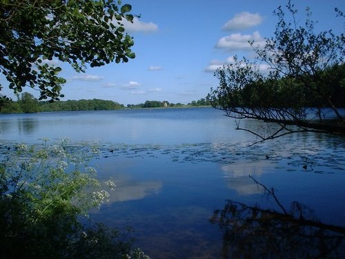
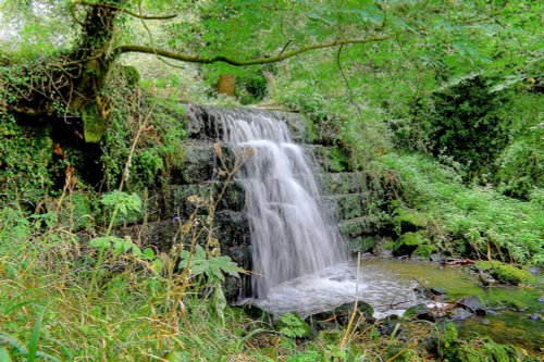
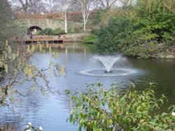
Clolemere is a countryside heritage site with miles of waymarked walks circling over 70 acres of water, woodland and sweet scented meadows...

The village of Grinshill, Shropshire, from the cliff of Grinshill

Grinshill (3 Pictures)

in the county of Shropshire (14.9 miles, 23.9 km, direction E)

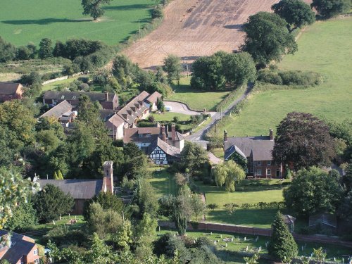
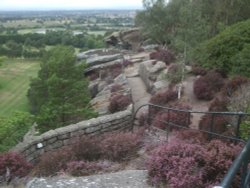
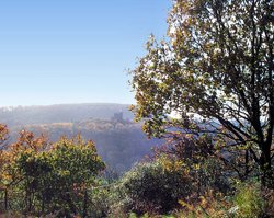
The picturesque village of Grinshill is spread beneath Grinshill Hill, an isolated rocky outcrop which rises above the plains of the Severn Valley...

Saint Ediths Church, Shocklach, Cheshire

Shocklach (1 Pictures)

in the county of Cheshire (15.4 miles, 24.8 km, direction NE)

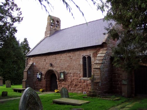
Shocklach is a small rural hamlet set beside a tributary of the River Dee between Wrexham and Nantwich. It is a lovely agricultural area of quiet lanes stringing together pretty.....

English Bridge, Shrewsbury

Shrewsbury (269 Pictures)

a Historic Market Town in the county of Shropshire (16.4 miles, 26.4 km, direction SE)

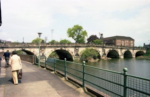
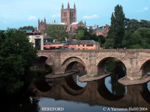
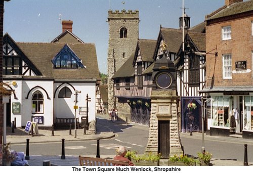
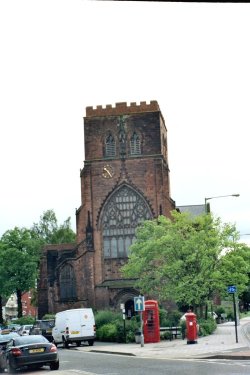
Shrewsbury is a wonderfully atmospheric town which beguiles the visitor with sights of bygone centuries and much a great charm is to be found in its narrow streets and medieval buildings...

Acton Burnell - the Castle

Acton Burnell (16 Pictures)

in the county of Shropshire (22.6 miles, 36.4 km, direction SE)

Interestingly, Acton Burnell has connections with America that go back to the stirring days of the Declaration of Independence in 1776...

St Helen's Church, Tarporley

Tarporley (15 Pictures)

in the county of Cheshire (26.4 miles, 42.5 km, direction NE)

Attractive large village which developed as a coaching stop on the main London to Liverpool road during the 17th and 18th-centuries...

The Town  Square of Much Wenlock, Shropshire

Much Wenlock (56 Pictures)

a Historic Market Town in the county of Shropshire (27.5 miles, 44.3 km, direction SE)

..

Recommended attractions near Oswestry

Gatehouse at Whittington Castle

Whittington Castle (2 Pictures)

(2.3 miles, 3.7 km, direction NE)

..

Chirk Castle Gardens, near Wrexham

Chirk Castle (16 Pictures)

(5.6 miles, 9.0 km, direction N)

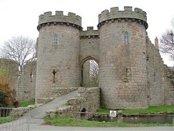
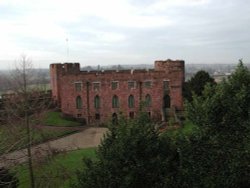
This magnificent building is the last of the great Welsh castles built by Edward I that is still lived in today. It was begun in.....

The Gardens at Erddig House, Wrexham (NT).

Erddig (3 Pictures)

(11.9 miles, 19.1 km, direction N)

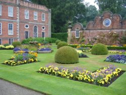
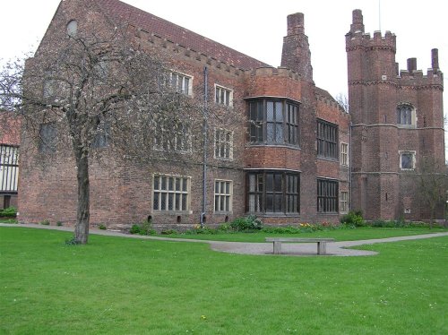
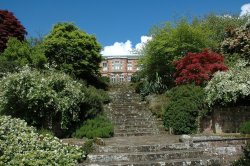
This large, handsome red-brick house was built during the 1680's by Thomas Webb for Joshua Edisbury, High Sheriff of.....

Powis Castle in Autumn

Powis Castle & Garden (53 Pictures)

(14.9 miles, 24.0 km, direction S)

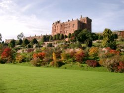
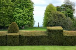
Powis Castle is a magnificent dramatic building rising above a hauntingly beautiful landscape. The castle sits on the borders of.....

Shrewsbury Castle

Shrewsbury Castle (19 Pictures)

(15.8 miles, 25.4 km, direction SE)

..

Dingle Gardens

The Dingle Gardens (17 Pictures)

(16.2 miles, 26.0 km, direction SE)

..

Shrewsbury Abbey. Shrewsbury, Shropshire

Shrewsbury Abbey (5 Pictures)

(16.7 miles, 26.8 km, direction SE)

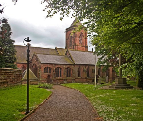
The site of Shrewsbury Abbey is an ancient one, quite possibly dating back to Saxon times when a wooden church would have stood.....

Moreton Corbet Castle, Moreton Corbet, Shropshire

Moreton Corbet Castle (2 Pictures)

(17.5 miles, 28.1 km, direction E)

..

at Haughmond Abbey, Shrewsbury, Shropshire

Haughmond Abbey (24 Pictures)

(17.8 miles, 28.7 km, direction SE)

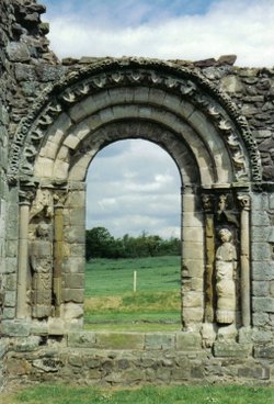
These magnificent remains of an Augustinian Abbey founded by William Fitzalan in about 1135, occupy a beautiful setting in the.....

Hawkstone Folly

Hawkstone Park (14 Pictures)

(18.0 miles, 28.9 km, direction E)

..

Hodnet Hall, Market Drayton, Shropshire

Hodnet Hall (3 Pictures)

(19.9 miles, 32.0 km, direction E)

Picturesque Hodnet Hall stands on the bank of a small valley, it is a handsome red-brick mansion designed in the 19th-century by.....

View out over Stiperstones, Shropshire

Stiperstones (9 Pictures)

(19.9 miles, 32.0 km, direction S)

The Stiperstones lie amongst the magnificent hill scenery of Shropshire and at 1,762 feet are the second highest range in the.....

Attingham Park

Attingham Park (25 Pictures)

(20.2 miles, 32.5 km, direction SE)

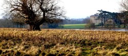
An elegant 18th century mansion with regancy interiors and deer park, Attingham Park is of the great houses of the.....

Cholmondeley Castle. A soldiers view in 1940. Tim Croft.

Cholmondeley Castle (19 Pictures)

(20.5 miles, 33.0 km, direction NE)

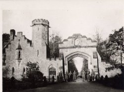
The village of Cholmondeley is famous for its fascinating, romantic castle, built in 1801 in the Gothic style. Built as the seat.....

Wroxeter Roman City (Viriconium) in Shropshire

Wroxeter Roman City (9 Pictures)

(21.6 miles, 34.8 km, direction SE)

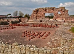
Wroxeter Roman City lies about 5 miles south-east of Shrewsbury, here lies the remains of what was the fourth largest town in.....

Loggerheads country park, Denbighshire

Loggerheads Country Park (2 Pictures)

(21.9 miles, 35.2 km, direction N)

..

Acton Burnell Castle, Shropshire

Acton Burnell Castle (4 Pictures)

(23.1 miles, 37.1 km, direction SE)

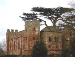
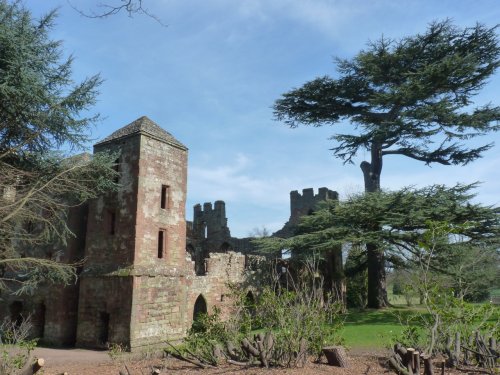
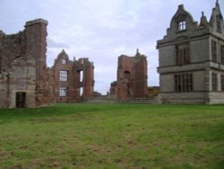
Although crenulated, the spectacular red sandstone ruins of Acton Burnell speak more of a grandiose place of comfort rather than.....

View of Long Mynd - Shropshire

The Long Mynd (18 Pictures)

(23.1 miles, 37.2 km, direction S)

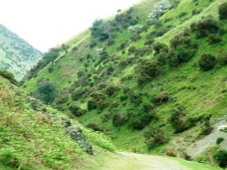
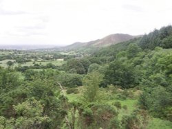
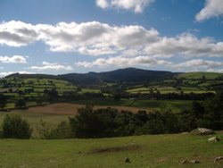
The Long Mynd (meaning "Long Mountain") is a 7 mile long heath and moorland plateau that forms part of the Shropshire hills and.....

Peckforton Castle, Cheshire, taken from the outer walls of Beeston Castle.

Peckforton Castle (9 Pictures)

(23.4 miles, 37.6 km, direction NE)

This modern day version of a 12th-century castle is set in the heart of the Cheshire Plains, an area which is scattered with.....

Looking towards Church Stretton

Carding Mill Valley & Long Mynd (11 Pictures)

(23.6 miles, 38.0 km, direction SE)

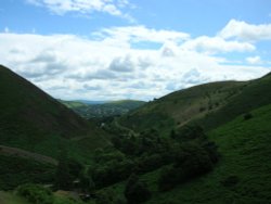
The bleak, heather clad Long Mynd lies to the west Of Church Stretton. It is a long lonely stretch covering some 10 miles in.....


All attractions in Oswestry
All attractions in Shropshire