 |
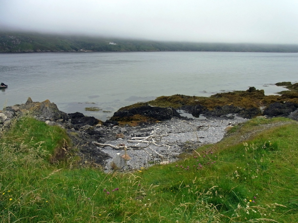
The Cape from Kyle of Durness The Cape can just be seen through the low cloud and sea mist. The Cape is separated from the mainland by the Kyle of Durness and is only accessible via a ferry, actually a very small boat with an outboard motor and 8 people evenly seated or 6 people and 2 bicycles, it's an adventure. This picture appears in the following picture tours: Camera Make: RICOH � Model: CX2 � |
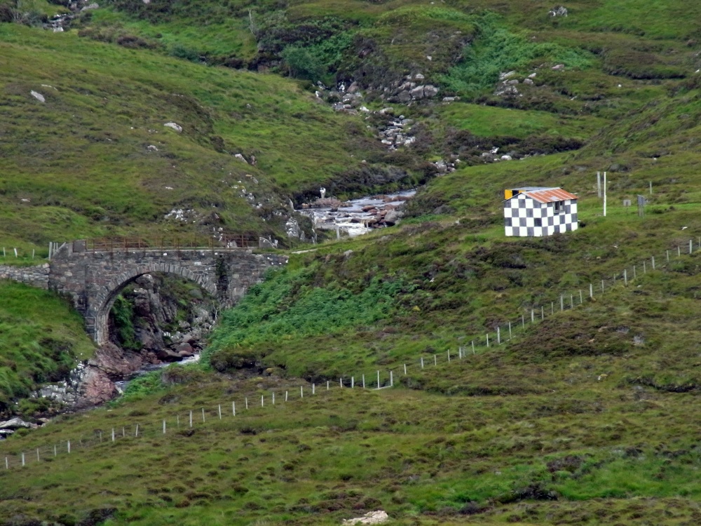 |
Stone Bridge over Kervaig River, Cape Wrath The only road on the Cape was built in 1828 by the lighthouse commission across the moorland. The road is only accessible via the passenger ferry that crosses the Kyle of Durness. The was land originally owned by the Duke of Sutherland, but much of it was sold to the armed forces in the 1930s for use as a military training area, it is still used today by the MOD with live firing and bombing ranges. The very rough road is about 11 miles (18 km) long and is the only link with the lighthouse from the Kyle of Durness. It was built in 1828 when the lighthouse was constructed. The road (the U70) passes Ministry of Defence check-points and access to the cape during live firing exercises is prohibited, for obvious reasons! This picture appears in the following picture tours: Camera Make: RICOH � Model: CX2 � |
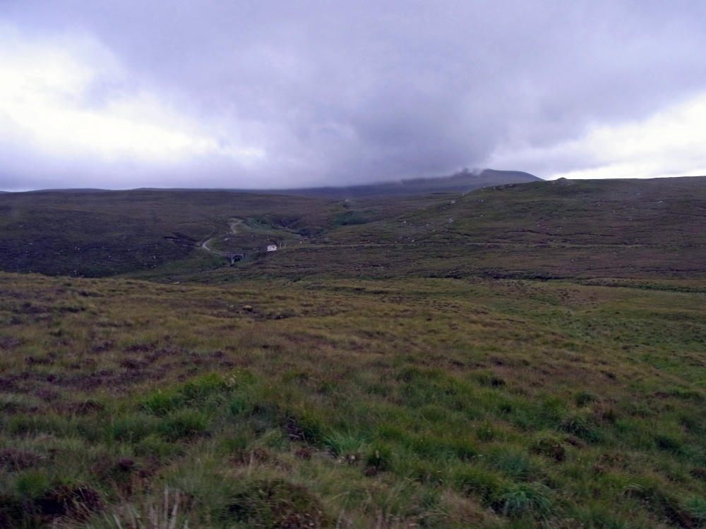 |
Moorland on Cape Wrath The Cape is separated from the mainland by the Kyle of Durness and is 277 square kilometres (107 sq miles) of moorland and wilderness. Some areas are of special scientific Interest and a Special Area of Conservation and Special Landscape Area. The land was originally owned by the Duke of Sutherland, but much of it was sold to the armed forces in the 1930s for use as a military training area. It is still used today by the MOD with live firing and bombing ranges. The road can be seen twisting along in the distance. This picture was taken when the mini-bus we were in broke down. A replacement was sent from the Lighthouse, thank goodness there was a second bus. This picture appears in the following picture tour: Camera Make: RICOH � Model: CX2 � |
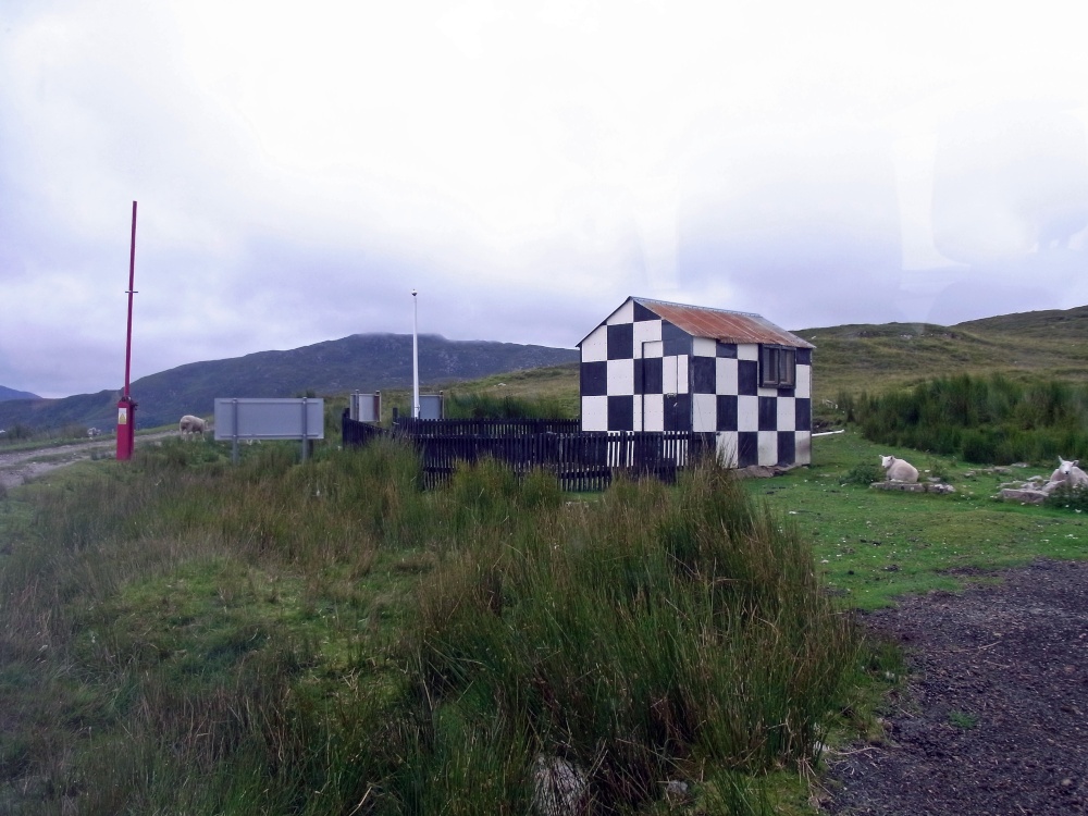 |
MOD check point on the Cape of Wrath The only road on the Cape was built in 1828 by the lighthouse commission across the moorland. The road is only accessible via the passenger ferry that crosses the Kyle of Durness.The very rough road is about 11 miles (18 km) long and is the only link with the lighthouse from the Kyle of Durness. It was built in 1828 when the lighthouse was constructed. The land was originally owned by the Duke of Sutherland, but much of it was sold to the armed forces in the 1930s for use as a military training area. It is still used today by the MOD with live firing and bombing ranges. The road (the U70) passes Ministry of Defence check-points and access to the Cape during live firing exercises is prohibited, for obvious reasons! This picture appears in the following picture tour: Camera Make: RICOH � Model: CX2 � |
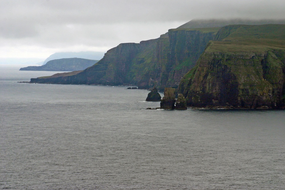 |
Cliffs of Cape Wrath Cape Wrath is the most north-westerly point on the British mainland. Iceland is approximately 519 km / 509 miles away. The name Cape Wrath is believed to be from Old Norse (havrf) ("turning point"). The Vikings are believed to have used the Cape as a navigation point where they would turn their ships and head for home. The sea cliffs around the cape rise up to 281 metres (922 ft) above sea level and include the highest sea cliffs on the British mainland This picture appears in the following picture tours: Camera Make: Canon� Model: Canon EOS 300D DIGITAL� 1 person has added this picture to their favourites |
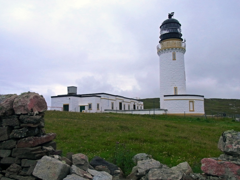 |
Cape Wrath Lighthouse Cape Wrath Lighthouse was built by Robert Stevenson in 1828 at a cost of fourteen thousand pounds on the most north westerly tip of the British Mainland. It stands on cliffs 120 metres above the Atlantic Ocean. In 1795 an idea to improve navigation would help if a lighthouse was built at Cape Wrath. During the previous ten years off the coast of Durness there had been a number of shipwrecks and it was believed that if the rocks could be accurately navigated it would save hundreds of lives. The Lighthouse tower is twenty metres high, with eighty one steps to the top and is built of stone. The rest of the building is built of large blocks of granite. The lighthouse went automatic in February 1998. This picture appears in the following picture tours: Camera Make: RICOH � Model: CX2 � |
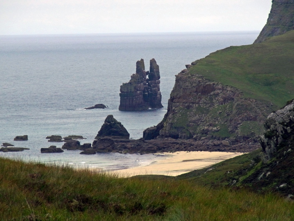 |
Cape Wrath Stac Clo, off of Kearvaig Beach on Cape Wrath, also known as "The Cathedral" because of its two spires and a natural window created by erosion This picture appears in the following picture tour: Camera Make: RICOH � Model: CX2 � |
Enjoy this site?
Please help us stay online by making a donation today - thank you for your kind support.

Follow PicturesOfEngland.com on social media and help share the beauty of England....