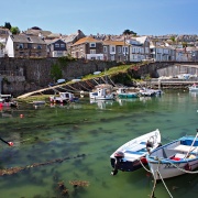
All over Britain on Ordnance Survey maps there are heights and contours shown. All over Britain there are Ordnance Survey bench marks etched onto substantial buildings from which the height of the bench can be assertained, not to mention all the triangulation pillars with their heights recorded. All these heights all over Britain are based on the Ordnance Survey Datum level based on the mean sea level at Newlyn. There is a fundamental bench mark sealed in the end of the harbour pier.