Please login or click here to join.
Forgot Password? Click Here to reset pasword
Exploring England with interactive maps of England. Explore the regions, counties, towns and discover the best places to visit in England. - Don't forget to bookmark us and share this page. If you were looking for something specific - Please contact us and let us know. You can use any of our free online maps including our regions or county map in exchange for a link back to this page from your website.
| Counties Map of England - See where all the counties of England are and explore each one. This is probably the most popular and wideley used map of England. | |
|
Regions Map of England - This Map shows the regions of England. Regions are clickable allowing you to explore the counties within them. |
|
| The
Historic Counties of Great Britain Map A map of the true ancient old counties of England and Great Britain. This map features the 86 traditional Counties of Great Britain. These differ from the Goverment Administrative county boundaries of today. Please visit The Association of British Counties (ABC) to learn more! |
|
 View london map |
London Map - A map of London exploring the different districts and attractions in London. More maps of London coming soon.
|
 |
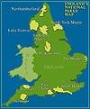
England's National Parks Map |
More maps coming soon including a map of London, Lake District, maps of england attractions and many more maps.
You are free to use any maps for your website but please link to us using the link below: