Please login or click here to join.
Forgot Password? Click Here to reset pasword
My village of Abram has existed since before the Conquest.
Both before and after the conquest it was part of the manor and fee of Newton (in Makerfield)
It is difficult to know what the area was like before the Industrial Revoloution. We have clues though as there are a coulpe of ancient farmhouses remaining in the area and although they are no longer standing a couple of halls. I think that it can safely be assumed that it was mainly a farming area.
However, 19th century industry was hungry for what Abram had a wealth of - COAL.
There was an abundance of coal in Abram and its satellite hamlets - Bickershaw and Bamfurlong, and thus dawned the industrialisation of the place.
A very unflatering description of the area can be found in <A HISTORY OF THE COUNY OF LANCASTER> by FARRAR & BROWNBILL- 1911.
<Abram is situated in the centre of a coal mining district, the surface of the country is flat except in the south, where it is very slightly undulating. The surroundings are characteristic of a coal producing district, distinctly unpicturesque,dingy grass fields alternating with collieries, pit banks and railway lines. Some fields are arable and produce crops of wheat and oats. There is much pasture land. Trees are in the minority, and stunted and blackened with smoke. The hawthorn hedges that divide the fields are low and spare. The soil is a stiff clay wich holds a quantity of water on its surface, for besides occasional "flashes"causd by mining, the fields appear to be flooded at most seasons of the year. It is a distrct of sett-laid roads and cinder paths..In the northern part of the township the geological formation consists of the Coal measures. At some distance from the southern boundary this formation dips under the New Red Sandstone and the intervening ermian Beds>
The authors in 1911 have painted a very dull and dreary picture of the area.
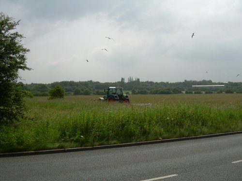
I think they would be very surprised to see it today. The mines have all but been wiped from the landscape, almost as if they never existed. It is only those who remember the mines as a working industry would recognise the clues that remain from those days.
The area has risen from the ashes and cinders and nature as taken over. The stunted blacked trees are no longer in evidence, they are verdant and stong and the poor field hedges are luxuriant. Native wildlife thrives.
| Article Title | Author | Date |
| Stonehenge | David Coe | 23rd January 2024 |
| Derwent Dam: A Historic Icon in the Heart of Derbyshire | David Coe | 14th January 2024 |
| The Native Trees of England: A Botanical Tapestry | David Coe | 15th December 2023 |
| Stoke-on-Trent: The Potteries Hub | David Coe | 12th December 2023 |
| England's 'Heritage at Risk Register' 2023 | David Coe | 11th December 2023 |
| 10 of the prettiest villages in the Lake District, Cumbria | poe | 16th March 2023 |
| Where to see Daffodil Displays in the South West of England | poe | 3rd March 2023 |
| 10 Famous Landmarks in Dorset | poe | 1st March 2023 |
| List of popular Dorset market towns including market day | poe | 1st March 2023 |
| 10 Best Historic Attractions to visit in York, England | poe | 16th May 2022 |
Follow PicturesOfEngland.com on social media and help share the beauty of England....