Pictures of England

Search:

Historic Towns & Picturesque Villages

Recommended Towns & Villages near Copt Oak

Groby Road, Anstey, Leicester

Anstey (5 Pictures)

in the county of Leicestershire (4.9 miles, 7.9 km, direction SE)

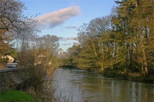
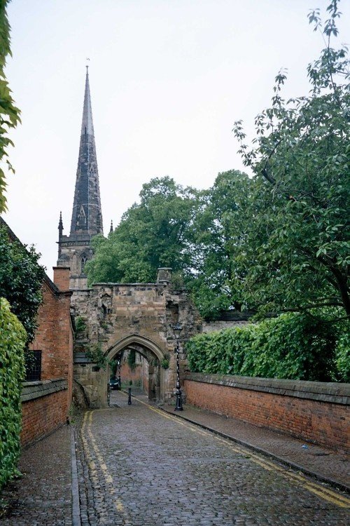
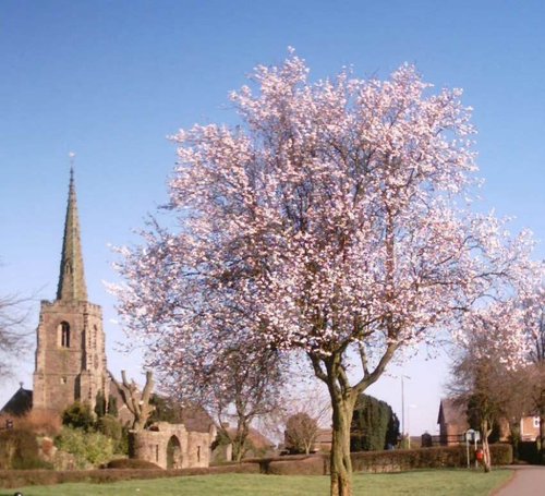
One of the most attractive features of Anstey is the famous 14th century five arched pack-horse bridge crossing the River Wreake...

Loughborough, Leicestershire

Loughborough (74 Pictures)

in the county of Leicestershire (5.4 miles, 8.6 km, direction NE)

The joyous sound of bells made in Loughborough have been rung all over the world since 1858, the date that John Taylor of Oxford moved his foundry to Loughborough. Many famous.....

Quorn in Leicestershire. The river Soar

Quorn (18 Pictures)

in the county of Leicestershire (5.6 miles, 8.9 km, direction NE)

Quorn can be found between Leicester and Loughborough, it is surrounded by magnificent countryside and a wealth of visitor attractions...

Rothley Railway Station

Rothley (12 Pictures)

in the county of Leicestershire (6.3 miles, 10.2 km, direction E)

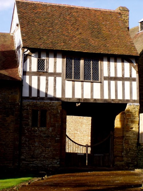
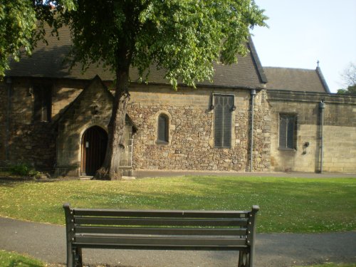
Rothley is a delightful village with two village greens, one is flanked by some of the country's finest timber framed houses. The village shows a graceful selection of architecture including pretty Cruck Cottages...

Gunpowder Plot Room Ashby de la Zouche, Leicestershire

Ashby de la Zouch (41 Pictures)

a Historic Market Town in the county of Leicestershire (8.0 miles, 12.8 km, direction W)

This town takes its name from the La Souche family, lords of the manor from about 1160. The Norman prefix distinguishes Ashby from other towns of similar name...

Town Hall in Leicester - June 2005

Leicester (362 Pictures)

a Historic City in the county of Leicestershire (8.1 miles, 13.0 km, direction SE)

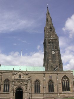
Leicester is famed amongst other things for its fine parish church which was raised to Cathedral status in 1927...

Lion photographed on roof of Staunton harold hall, by richyp. 2002

Staunton Harold (22 Pictures)

in the county of Leicestershire (8.2 miles, 13.1 km, direction NW)

Staunton was mentioned in the Doomsday Book when it was held by Henry de Ferrers...

Taken in the Hall Yard Park looking towards St Simon & St Judes Parish Church, Earl Shilton

Earl Shilton (1 Pictures)

in the county of Leicestershire (9.7 miles, 15.6 km, direction S)

Earl Shilton is one of the largest villages in the County of Leicestershire. It occupies a rich rural landscape between the town of Hinckley and the City of Leicester...

The Church of St James in the village of Swarkestone, Derbyshire.

Swarkestone (9 Pictures)

in the county of Derbyshire (12.1 miles, 19.4 km, direction NW)

Swarkestone is a small enchanting village which grew up on the reeeded banks of the River Trent...

Long Eaton Lock, Erewash Canal

Long Eaton (98 Pictures)

in the county of Derbyshire (12.9 miles, 20.8 km, direction N)

Long Eaton is a small town lying on the River Trent around 8 miles east of Derby. The town has a history stretching back to the 7th century, but was for many centuries naught but a sleepy agricultural village...

Repton, Derbyshire

Repton (9 Pictures)

in the county of Derbyshire (14.0 miles, 22.6 km, direction NW)

Repton is one of England's most ancient towns, it was once the capital of the Saxon Kingdom of Mercia and the church there is the burial ground of Saxon Kings...

River Trent Beeston, Nottinghamshire, looking towards Clifton.

Beeston (270 Pictures)

in the county of Nottinghamshire (15.0 miles, 24.2 km, direction N)

Beeston is mostly remarkable for being the place where the Ist Lord Trent started work in his mother's herbal shop at the age of 14...

Irongate, Derby.

Derby (68 Pictures)

in the county of Derbyshire (16.4 miles, 26.4 km, direction NW)

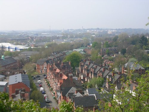
This is the premier town of the Shire, it is steeped in history with roots stretching to Roman times - the legions had a camp near the east bank of the Derwent, but the town was.....

Off Burton Bridge, Burton upon Trent, Staffordshire

Burton upon Trent (54 Pictures)

in the county of Staffordshire (16.4 miles, 26.4 km, direction NW)

Burton-on-Trent is an attractive town, it has a pleasing market place surrounded by pleasant properties, some being timber-frame black and white...

Trowell, Nottinghamshire

Trowell (3 Pictures)

in the county of Nottinghamshire (16.7 miles, 26.8 km, direction N)

Modern day history records that this was the village chosen as The Festival of Britain Village, at the time it was considered to epitomise the spirit of British rural community life...

The fine old church at Tilton-on-the-Hill, Leicestershire

Tilton on the Hill (4 Pictures)

in the county of Leicestershire (17.0 miles, 27.4 km, direction E)

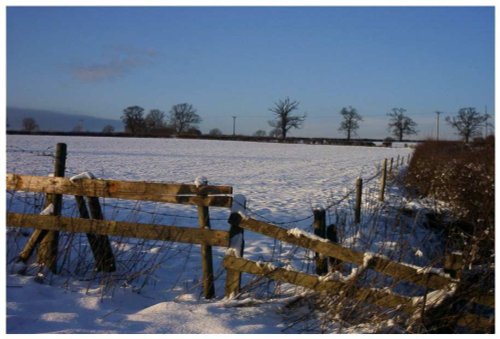
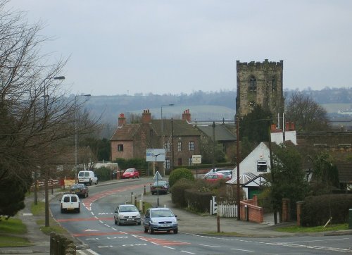
This is a quiet rural village situated in one of the highest parts of the rolling Leicestershire countryside...

The view from Burrough Hill

Melton Mowbray (25 Pictures)

a Historic Market Town in the county of Leicestershire (17.3 miles, 27.8 km, direction E)

An historic market town famous for its Pork packed pies and Stilton cheeses, both are savoured all over Britain and in many other countries...

St Mary's Church, Nottingham

Nottingham (210 Pictures)

a Historic City in the county of Nottinghamshire (17.7 miles, 28.5 km, direction N)

The City of Nottingham is famed for fine lace, the romance of Maid Marion and Robin Hood and as the birthplace of the founder of the Salvation Army, General William Booth (1829-1912)...

Tamworth Castle, Staffodshire

Tamworth (32 Pictures)

a Historic Market Town in the county of Staffordshire (17.7 miles, 28.5 km, direction W)

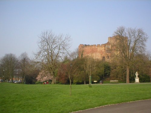
In the 8th century the Saxon Kingdom of Mercia was ruled from Tamworth. Later in AD 913, a fortress was built here by the daughter of King Alfred...

St Mary's Church, Ilkeston, Derbyshire during the Annual Fair in October

Ilkeston (38 Pictures)

in the county of Derbyshire (17.8 miles, 28.6 km, direction N)

Within this pretty hilltop town you will find the ancient church dedicated to St.Mary, it was built around 1150 and has a beautiful clock-face tower...

Recommended attractions near Copt Oak

The Old Man of Beacon, Beacon Hill Country Park, Leicestershire

Beacon Hill Country Park (24 Pictures)

(2.4 miles, 3.8 km, direction NE)

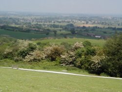
The second highest point in Leicestershire at 245m (802 feet) and containing a Bronze Age hill fort, Beacon Hill Country Park.....

Old John, Bradgate Park, Leicestershire

Old John Tower (10 Pictures)

(2.9 miles, 4.7 km, direction E)

Standing on a hill overlooking Bradgate Park, Old John Tower folly.....

Thornton Reservoir, Leicestershire.

Thornton Reservoir (13 Pictures)

(3.4 miles, 5.5 km, direction S)

..

Bradgate Park, Leicester, leicestershire

Bradgate Park (257 Pictures)

(3.8 miles, 6.1 km, direction E)

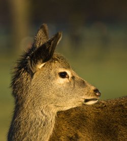
Comprising of 850 acres of land with roaming deer, Bradgate Park is Leicestershire's largest and most popular country.....

Letting off Steam on the Great Central Railway

Great Central Railway (48 Pictures)

(5.5 miles, 8.8 km, direction NE)

..

Staunton harold hall & Church, Leicestershire

Staunton Harold Church (6 Pictures)

(7.3 miles, 11.7 km, direction NW)

Imposing church built in 1653, with fine panelled interior, set in attractive parkland...

View from the tower Ashby de la Zouch Castle, Leicestershire

Ashby de la Zouch Castle (28 Pictures)

(7.6 miles, 12.2 km, direction W)

The ancient, crumbling walls of Ashby de la Zouch castle keep once rose to a towering 95ft and had four floors. It belonged to.....

Staunton Harold Church

Staunton Harold Hall (14 Pictures)

(8.1 miles, 13.0 km, direction NW)

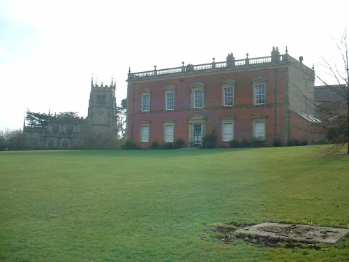
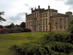
This is said to be one of the most delightful country houses in Leicestershire, it was the former home of the Ferrers family who.....

Jewry Wall, A small piece of the Roman Wall still remains in Leicester City Centre.

The Jewry Wall Museum (15 Pictures)

(8.1 miles, 13.1 km, direction SE)

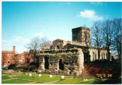
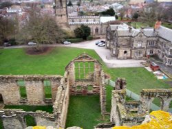
This is Leicester's leading Museum of Archaeology, showing an extensive range Roman finds as well as other unique historic relics.....

A picture of Watermead Country Park

Watermead Country Park (174 Pictures)

(8.2 miles, 13.2 km, direction E)

..

Leicester Cathedral, Leicester

Leicester Cathedral (16 Pictures)

(8.5 miles, 13.6 km, direction SE)

..

Le Mans Series racers at the Melbourne Hairpin, Donington Park Circuit, Derbyshire

Donington Park (11 Pictures)

(9.0 miles, 14.4 km, direction NW)

..

image of staunton harold reservoir taken from hall roof, 2003

Staunton Harold Reservoir (5 Pictures)

(9.8 miles, 15.7 km, direction NW)

..

Calke Abbey, Derbyshire

Calke Abbey (57 Pictures)

(10.0 miles, 16.2 km, direction NW)

Calke Abbey was built between 1701-1703. The building, in the Baroque style, was built for Sir John Harpur. It is an.....

Twycross Zoo, Leicestershire. Prairie Dog

Twycross Zoo (58 Pictures)

(10.9 miles, 17.6 km, direction W)

Come face-to-face with over 900 animals of more than 150 species, including some of the most endangered on our planet, at.....

Elvaston Castle

Elvaston Castle (41 Pictures)

(13.5 miles, 21.7 km, direction N)

The first view of this impressive early 19th-century house nestling above sweeping lawns is quite tantalizing, giving visitors a.....

Hartshill Hayes Country Park, Nr Atherstone, North Warwickshire.

Hartshill Hayes Country Park (88 Pictures)

(15.0 miles, 24.1 km, direction SW)

..

Derby museum and Art Gallery, the Wardwick, Derby.

Derby Museum and Art Gallery (1 Pictures)

(16.7 miles, 26.8 km, direction NW)

This exceptional museum is housed in an impressive building of modern times. It gives visitors of every age a fascinating.....

Derby Cathedral, Derby, Derbyshire.

Derby Cathedral (7 Pictures)

(16.7 miles, 26.8 km, direction NW)

..

Young Buck

Wollaton Hall (58 Pictures)

(16.8 miles, 27.0 km, direction N)

From the outside, Wollaton Hall could easily be mistaken for a grand Victorian mansion - even though it was built when Sir.....


All attractions in Copt Oak
All attractions in Leicestershire