Please login or click here to join.
Forgot Password? Click Here to reset pasword
The tiny hamlet of Woolsthorpe-by-Colsterworth lies in spacious rural countryside in the valley of the River Witham...

This delightful town, set on the River Witham in a spacious agricultural region is noted for many historic factors but more latterly as the birthplace of Britains first woman Primne Minister - Margaret Thatcher was born here in 1925 and she became Prime Minister in 1979...
The popular village of Belton lying north of Grantham is home to magnificent Belton House. It is also a typical "Estate" village which perfectly epitomises all the values of English country life...
An historic market town famous for its Pork packed pies and Stilton cheeses, both are savoured all over Britain and in many other countries...

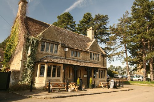
For centuries the countryside around Oakham has echoed to the sound of hunting horns, for the vales and rolling farmland surrounding this sedate market town, have been the stamping ground for the counties hunting fraternity...
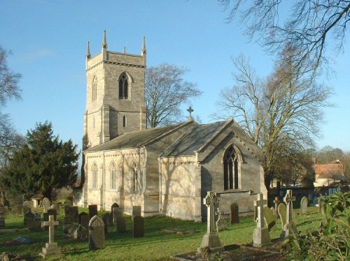
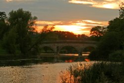
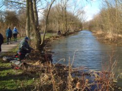
Normanton lies in a landscape of rolling farmlands, broken only by rivers and patches of woodland. It is a tranquil place, with the waters offering scope for sailing and other water-sports, bird-watching, fishing, and cycling...

The village lies on the southern shores of Rutland Water, one of Europe's largest man-made reservoirs, and England's premier fly fishing waters...
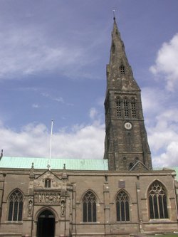
Of the 17 churches, only 6 now remain in Stamford, which is without doubt, one of the finest medieval towns in the British Isles, if not in Europe...

Cranwell is best known as the home of the Royal Airforce College which became the first military air academy in the world when it opened its doors to would be fliers in 1920...

Helpringham is a richly rewarding walking area, with walks around old villages and waterside walks giving visitors a lovely glimpse of the regions natural wildlife and variety of scenery...
Bisbrooke lies amidst a landscape of gentle hills dotted with rolling farmlands, rivers, reservoirs and woodland...
This is a quiet rural village situated in one of the highest parts of the rolling Leicestershire countryside...
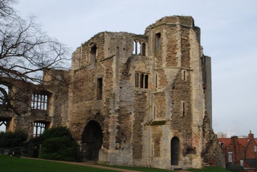
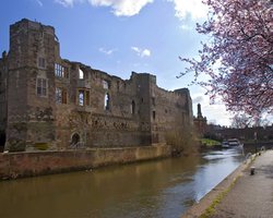
As it's name implies, this town enjoys a fine position on the River Trent. The great castle where King John died in 1216 lies in ruins on the banks of the river...

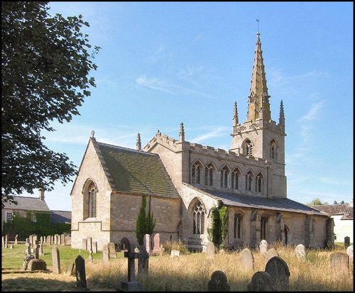
Stapleford is a village lying in the picturesque valley of the River Witham...

Lovely Lincolnshire village with a history stretching back to the Doomsday Book and possibly beyond...
This is a tranquil village set in a lovely rural location in the vale of the Digby Beck watercourse...
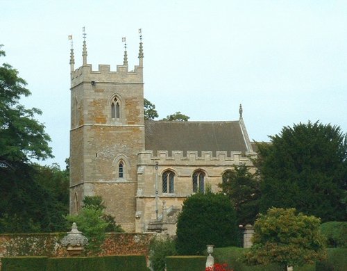
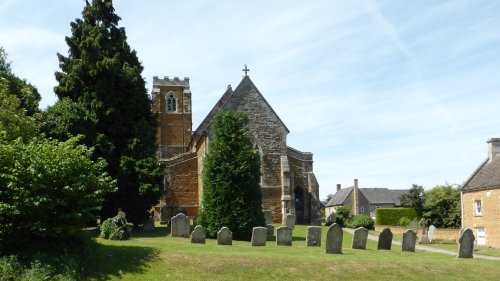
Apethorpe is a small, picturesque, East Northamptonshire village, a mile and a half from Kings Cliffe. St Leonard is an attractive looking church in a nice setting. Trees.....
Boothby Graffoe is one of the springline villages lying on the vast Lincolnshire plain. It is a sparsely populated hamlet of immense charm with a history that travels back over hundreds of years...

In springtime, the town of Spalding, in it's favoured position on the banks of the River Welland becomes a riot of blazing colour as tulips, daffodils and other glorious spring flowers come into bloom...

Bassingham, mentioned in the Doomsday Book, is a large, flourishing village located close to the banks of the River Witham, a few miles south-west of the Cathedral City of Lincoln...
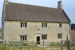
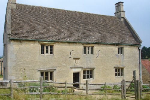
Called a manor but in reality this is the farmhouse where Isaac Newton was born in 1642. The house remains very much during.....
A castle has stood on this spot since the 11th-century, it was built by Robert de Todini, standard-bearer to William the.....
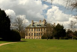
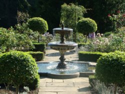
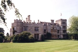
Belton is the perfect example of a home belonging to an English country gentleman, and yet it is a delightful Anglo-Dutch.....
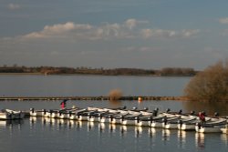
Rutland Water is the largest reservoir in England (by surface area) and one of the largest artificial lakes in Europe. Its.....
This is a graceful house which perfectly epitomises the wealth of the prosperous Elizabethan period. Burghley was completed in.....
The romantic ruins of this once glorious castle were left to fall into further disrepair following the ravages of the English.....

..
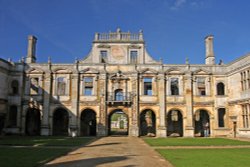
Looking around the romantic ruin of Kirby Hall it is easy to imagine the splendour of an age when romance was all, and great.....
..
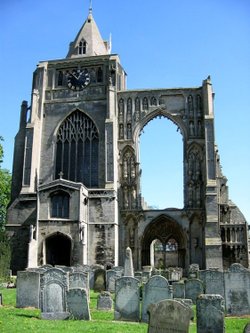
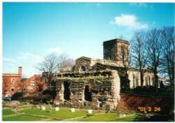
Historically a monastery was probably founded here in the 10th century, with the church being begun around 1108. The building.....
..
Crowland Abbey was founded in 716 by King Ethelbald, in memory of St.Guthlac who had built a cell on the Fen island. It has a.....
..
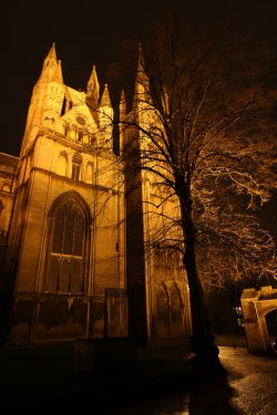
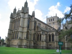
The magnificent cathedral church in Peterborough was given cathedral status by Henry VIII in 1541. Formerly it had been one of.....
..
This is a wonderful heritage museum which began when the site was uncovered during excavations of 1982. It focus's on the.....
This is Leicester's leading Museum of Archaeology, showing an extensive range Roman finds as well as other unique historic relics.....

Looking at the huge red brick keep perched in its lofty setting the visitor is immediately struck by the strong French influences.....
..

..
Follow PicturesOfEngland.com on social media and help share the beauty of England....