PicturesOfEngland.com Member Login
You are not logged in.
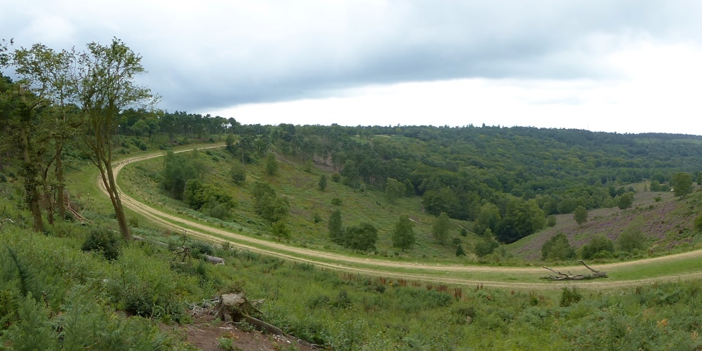
The Lip Of The Bowl
What we see here is the edge or lip of the Devil's Punchbowl and the sweeping bend is what is left of the old A3 and I do remember sitting in queues here in the past. Looking over the edge you can see into the bowl and it is a mix of wooded areas and heath type areas with heather growing and in full colour at this point in time. If you take a check on POE pic number 1194724 you can see the the entrance to the longest tunnel of recent construction taking the A3 away from the sensitive area of the Punchbowl allowing nature and wildlife to return where it belongs.
Oh and you ask why is it the " Devil's Punchbowl " ? Well it seems the devil was annoyed by the number of churches being built in Sussex so he planned on making lots of channels across the countryside connecting to the English Channel so that they would be flooded. The large tufts of earth he threw up became the hills dotted about the south eg Chanctonbury Ring, but he was thwarted in an area now called "The Devil's Dyke". Legend also says he took great pleasure throwing these giant divots up at the god Thor and the place he scooped out his missiles of earth took the name Devil's Punchbowl and the nearby village to the Punchbowl called Thursley translates as Thor's Place.
Browse all Devils Punchbowl images Add to favourites

Comment by Patrick Hogan(25th August 2015)
An amazing sight....... They have ripped all the old road up! I to remember sitting in queues on that stretch of the A3. Thanks for showing how it is now.
pictures by this user user profile user contact
Please add a comment..
Please login to make a comment on this picture
Camera Make: Panasonic� Model: DMC-TZ60�
Exposure Program: Program, Focal length: 4.3 mm, ISO: 100, Exposure time: 1/125 sec, Metering Mode: Multi-Segment, Exposure Bias: 0 EV
Date/Time Creation: August 19, 2015, 1:56 pm
ImageID:1197994, Image size: 1712 x 856 pixels
